The Milwaukee Casque
Where Byron Preiss's verse and painting lead inside Lake Park, what has already been dug up there, and what is left to check on the ground.
The casque is almost certainly buried in Lake Park, just north of the Grand Staircase: on the slope between the Locust Street Ravine Trail and East Ravine Road, in the lower part of the trail, short of Lincoln Memorial Drive.
- Zone center43.06892 N, 87.86836 W
- Zone sizea strip of about 40 × 15 m along the trail
- City and parksolid
- Route to the bridgesolid
- Final zonelikely
- Exact spoton site only
The fifth tree that marks the spot is gone: the birches on the slope were cut down, and the slope was reworked twice by construction in 2021–2023. The casque may be intact, crushed, or scooped out with the soil.
How the puzzle works
The book holds 12 paintings and 12 verses with no pairing given. The three casques found so far share one pattern: the painting names the city and confirms views along the way, and the verse walks you step by step from a recognizable landmark to a man-made marker, where a ceramic casque with a key is buried. The key is traded for a gemstone. For Milwaukee the book's gem is an amethyst, the month February, and the immigrant nation Germany.
The city: what the painting shows

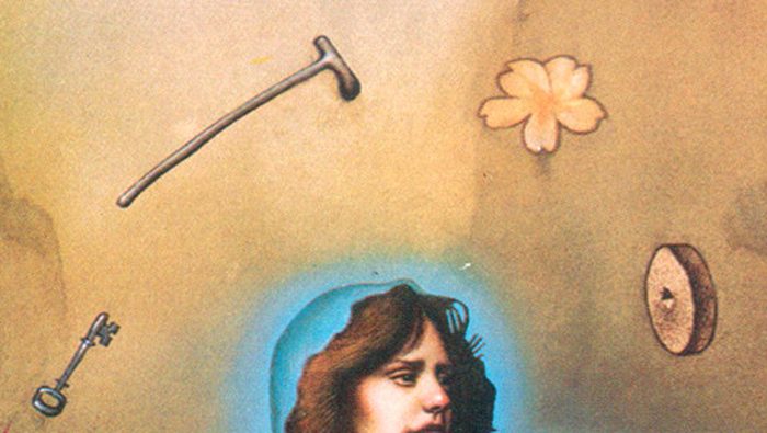
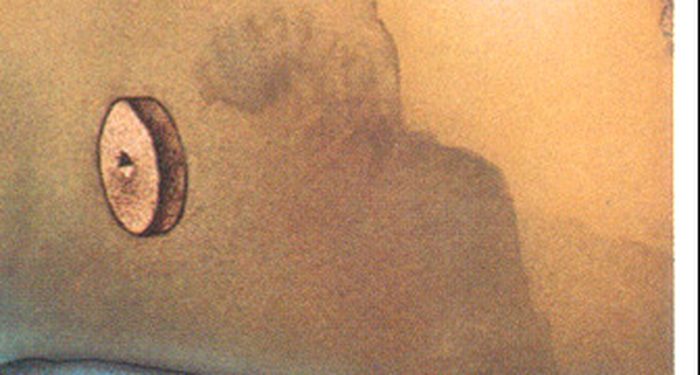
- The juggler's rebus. Millstone (mill), cane (walk), key (key): Mil-wau-kee. This is the main pointer to the city, and nobody disputes it.
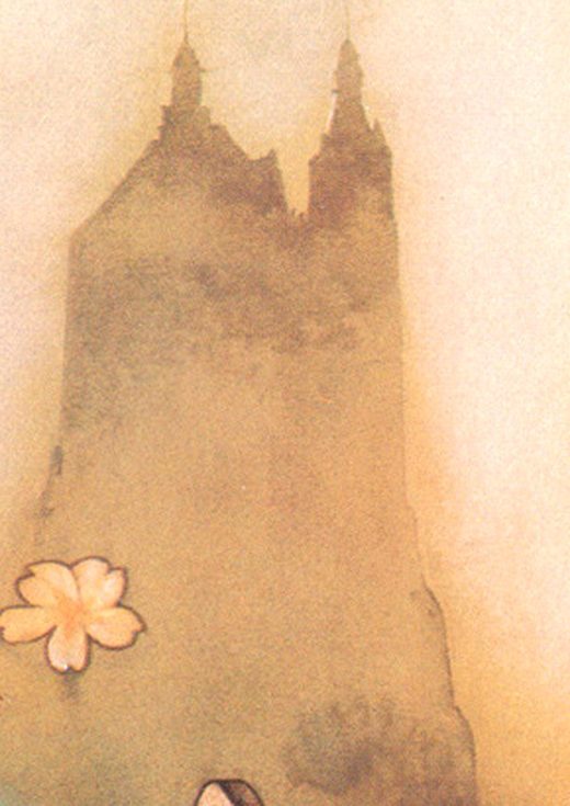
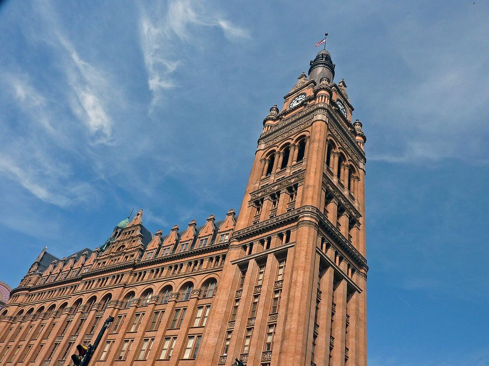
- The tower in the mist. Its outline matches Milwaukee City Hall seen from the corner of Water Street and State Street.
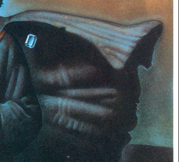
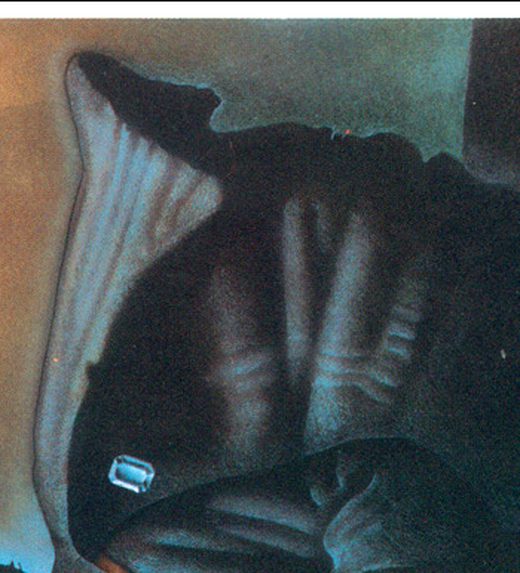
- February. The cut stone on the cloak is an amethyst, the flower a primrose. Both are February symbols, which by the book's structure means Germany.
- No coordinates. Most paintings hide latitude and longitude digits. This one has none, but more city-level clues than usual.
- The lower edge of the cloak traces the Wisconsin shoreline of Lake Michigan.
Verse 8
The verse, line by line
| Lines | What it is on the ground | Why | Rating |
|---|---|---|---|
| 1 | Mitchell Hall, the three-story UWM building at Kenwood Blvd and Downer Ave | The campus building closest to Lake Park. The Japanese-edition hint says the “stories” are floors, not tales | solid |
| 2 | Walk east on East Kenwood Boulevard | The only street running from Mitchell Hall straight to the park. The wordplay is weak (Kenwood mixers were advertised as a “World Beater”), but the geography is unambiguous | solid |
| 3–4 | Cross Downer, Hackett and Shepard Avenues | Three streets on the way, named after early Milwaukee residents | likely |
| 5–7 | Cross Marietta Avenue | Marietta Robusti, Tintoretto's daughter, stands at a harpsichord in her self-portrait. The next street after Shepard | likely |
| 8–9 | Enter Lake Park and turn onto Lincoln Memorial Drive | A penny is cast in copper and shows Lincoln and the Lincoln Memorial. The drive runs along the lake to the foot of the staircase. The Oak Leaf Trail was still called the “76 Bike Trail” in 1981, so the “leaf” reading fails | likely |
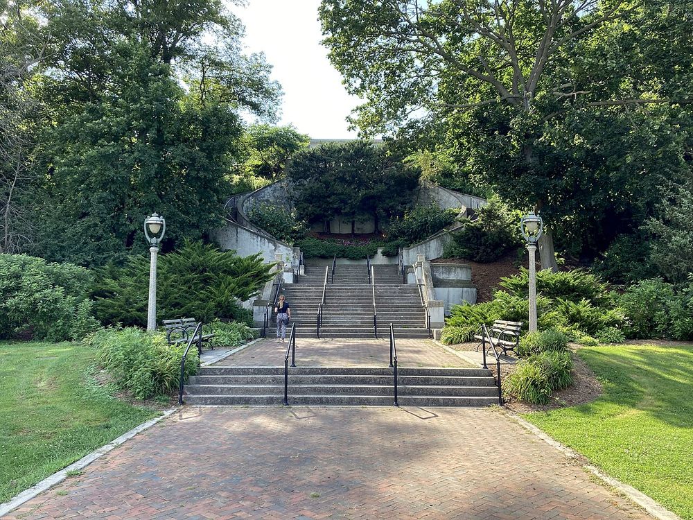
| 10 | The Grand Staircase, 1908 | Counted on site by several people: 92 steps from the concrete footing to the top along one side. 95–96 in all with the detached lower flight | solid |
| 11 | The same staircase | Seen from above it forms a double C, so CC = 200 in Roman numerals. Alternative: 92 + 8 central steps on both sides = 200. Both readings point to the same place | likely |
| 12 | The lamppost at the top with the compass-and-G emblem; turn right, north | Compass as a drawing instrument. The dating of these bases is disputed (the “harp” lamps came to the park in 1977 or in the 1990s). The route holds without this line: bridge and culvert are 50 m from the stairs | disputed |
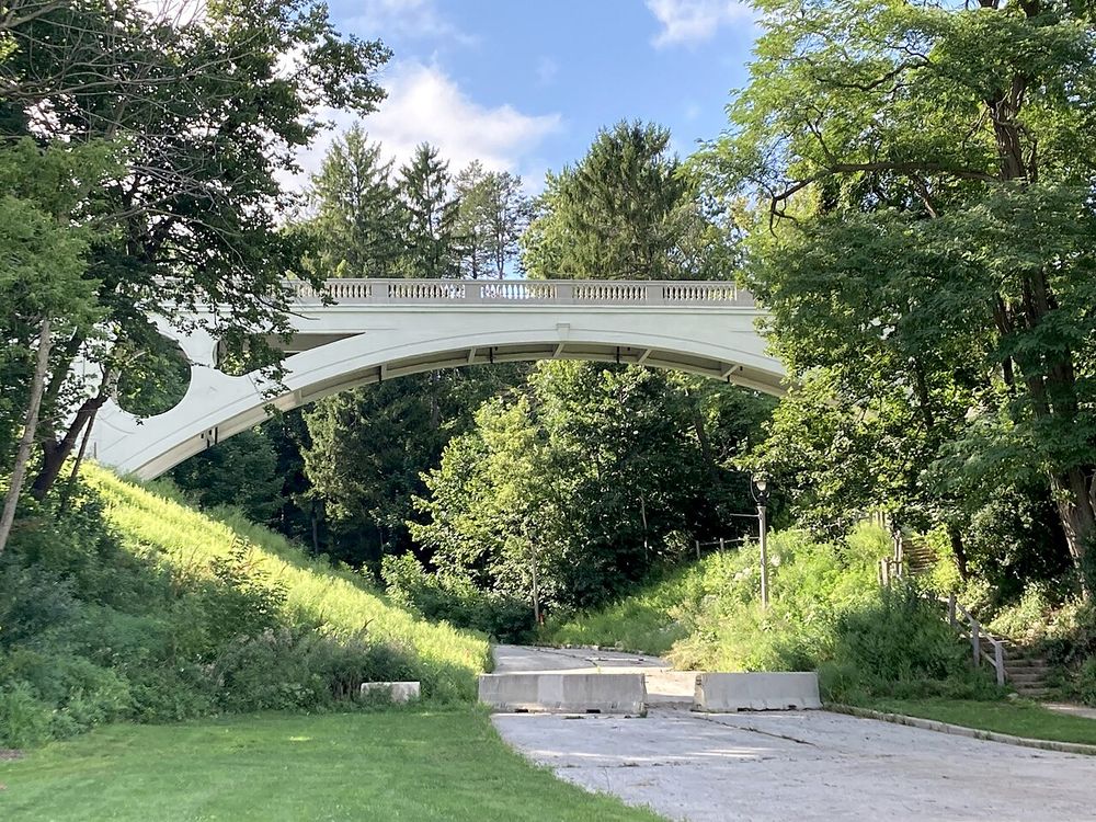
| 13–14 | The drain at the northeast end of the 1905 concrete arch bridge over East Ravine Road; the trail passes under it | The only bridge with a culvert near the stairs. The two red balls in the painting echo the two circular openings in the arches. The shape next to the millstone is read as a cicada nymph: “locust”, the name of the ravine and the trail | likely |
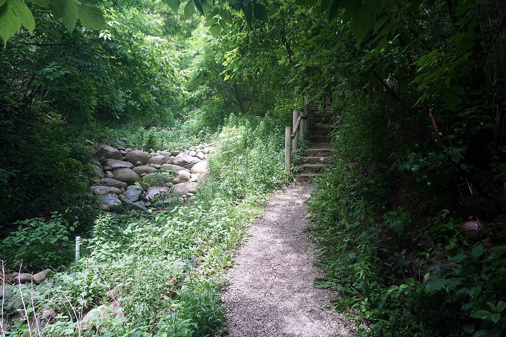
| 15–16 | Down the Locust Street Ravine Trail to Lincoln Memorial Drive | The trail runs southeast, dirt alternating with stone steps. From the point under the bridge to the road is about 90 m by OSM data, exactly 100 paces of 0.8–0.9 m | solid |
| 17–18 | A clump of birches on the slope between the trail and the road; “staying west” means not crossing Lincoln Memorial Drive | A 1970s photo from the historical society archive shows birches with shapes carved into the bark right here. By 2018 only stumps remained | likely |
| 19–21 | A mark on the fifth tree: a carved letter or a metal sign. The “country of wonderstone's hearth” for this casque is Germany, so most likely a G or an umlauted letter | Girl Scouts put metal signs on trees in Lake Park in 1981. The stripes inside the cloak, rotated 90°, look like five birch trunks, and the straight stripe with a bend like the vent pipe by the drain | marker lost |
| 22–23 | The southern foot of the fifth tree | The concrete drain disk at the bottom of the trail repeats the millstone in the painting and works as a “you are here” sign. Dig slightly uphill, short of the disk | likely |
The fork at the “compass”: two routes
A. Right, to the 1905 bridge chosen
Compass on the lamppost, bridge with two round openings, drain, trail under the bridge, 100 paces to the road. This route explains six elements of the painting at once: the two balls, the cicada, the millstone, the birch trunks, the pipe, and the absence of architectural detail.
Against it: the emblem lamps may postdate 1981; the zone has been dug through twice by construction.
B. Left, to the lighthouse shelved
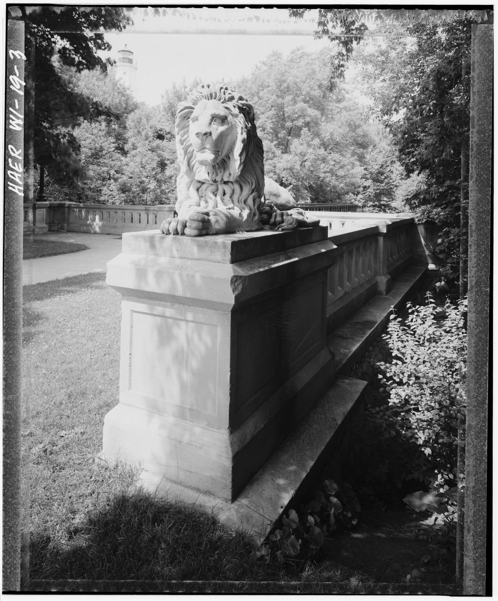
North Point Lighthouse as the “compass”, the Lion Bridges as the “bridge”, the lighthouse ravines as the “culvert”. 100 paces on trails 200–300 m long end at nothing distinctive.
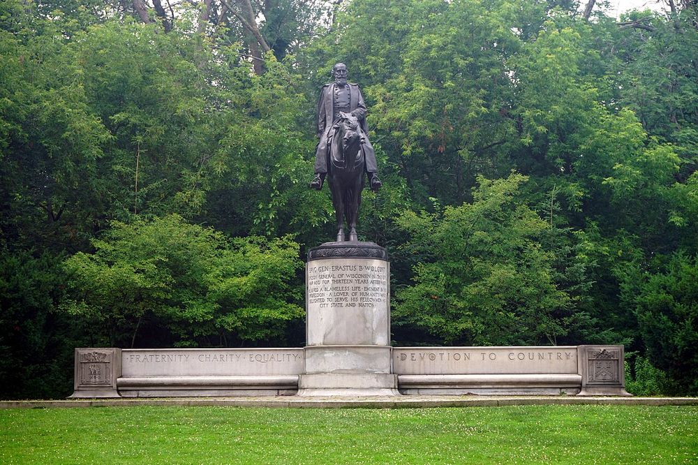
Tested and not confirmed: a dig at the cottonwood with a Girl Scout sign at the south ravine (2006), a dig at the lion's paws (2008), ground-penetrating radar at 6–7 spots (2014), the Wolcott statue (2014).
What has happened to the site
- 1905 · 1908The arch bridge over Ravine Road and the Grand Staircase are built.
- 1972–1998Girl Scouts lead an annual hike through Lake Park. In 1981 metal signs are mounted on trees.
- 1981 · 1982Preiss buries 12 casques. The book comes out in 1982.
- 1983 · 2004 · 2019The Chicago, Cleveland and Boston casques are found.
- 1999–2000Lincoln Memorial Drive is widened and rebuilt.
- 2006 · 2008Digs at the south lighthouse ravine and at the lion: nothing.
- 2014Ground-penetrating radar over the main theories: no anomalies. The bridge is closed to cars.
- 2016The bridge is closed to pedestrians too.
- March 2018An unauthorized dig beside the concrete disk: crockery shards, no casque. The hole is left open and the park hardens its stance.
- 2021–2022Bridge rehabilitation: abutments and wingwalls replaced, new drainage and riprap on the slopes, the trail's stone stairway rebuilt. The slope under the bridge is regraded.
- November 2023The pipe and the concrete disk at Lincoln Memorial Drive are rebuilt. The birch stumps are smoothed over with the slope.
What to do on the ground
- No shovel first. Walk the Locust Street Ravine Trail top to bottom, find the remains of stumps between the trail and Ravine Road, photograph the slope from the southwest corner of the bridge to compare with the 1970s photo.
- Check the cloak view. Stand on the slope north of the pipe and look south through the trunks. If the stripe pattern matches, the fifth tree in that group is the target.
- Probe, not metal detector. The casque is ceramic with no metal inside. Radar on a slope full of roots and rock came back empty. Only a thin probe on a grid to 60–90 cm works.
- Permission. Digging in Milwaukee County parks requires a right-of-entry permit from Milwaukee County Parks. According to a 2018 letter from the park the fee is about $1,000, insurance is required, and anything found is treated as county property. Digging without a permit risks a fine, and the park has been refusing since 2018.
- Negotiate instead of digging in secret. It worked in Boston: the searchers went to the city and the casque was recovered together with park staff. It is the only path that does not poison relations for years.
The Girl Scout lead
The most intriguing thread in this puzzle comes neither from the painting nor the verse but from a scout troop's archive. A searcher known as Animal Painter pulled it out in 2008 while going through the papers of the Milwaukee Girl Scouts' Trail of the Parks program.
What is documented
- From 1972 to 1998 the Girl Scouts led an annual hike through Lake Park and printed a new trail guide every year.
- In the early years they navigated by landmarks. In 1981 two metal trail signs were embedded in trees along the route, plus a round one reading “Hiking Trail”.
- The 1988 guide says plainly: “Past Bradford Beach, watch for trail sign on tree as you enter the first ravine.”
- The original route went to a second “Girl Scout tree” by the soccer field and back up to the pavilion. That section was cut later.
- When the route was abandoned the park removed the signs, leaving only those that had grown into the bark. None are visible on the trees today.
- One of the park's ravines, Waterfall Ravine south of the pavilion, is still called Girl Scout Ravine by old-timers.
Why it matters
Preiss buried the casques in 1981, the very season the signs went up on the trees. The line “you'll see a letter from the country of wonderstone's hearth on a proud, tall fifth” describes not a carving but something you “see” on the trunk. A metal sign on the fifth tree fits that description better than any other version. And the “letter” would then be G: the first letter of Germany and of Girl Scouts alike.
Preiss clearly used whatever he saw on site during a single walk and did not think about what would survive decades. In Chicago the marker was a fence, in Cleveland a planter wall. A sign on a tree would have seemed just as good to him.
Why the lead has not paid off yet
- The “first ravine past Bradford Beach”, walking north, is the south ravine at the lighthouse. That is where people dug: at the big cottonwood at the ravine entrance (May 2006), at the stone lion's paws (2008). The cottonwood's trunk showed a flat patch where a sign may have hung. No casque.
- In 2007 a tree with a carved G was found near the golf course; a permit was obtained and the spot dug. Also empty.
- The guide for 1981 itself has not surfaced publicly. Without it nobody knows whether the scout route passed through the Locust Street ravine at the bridge, the zone the verse leads to.
The “letter from the country”: every version
| Version | Logic | What was found |
|---|---|---|
| Girl Scout sign (G or GS) | Mounted in 1981, something you “see” on a trunk, G as Germany | Removed by the park. The cottonwood at the south ravine checked, empty |
| A letter carved into a birch | A 1970s photo shows marks on birch bark by the bridge | Birches cut down, stumps smoothed over in 2023 |
| An umlauted letter (Ä, Ö, Ü) | A letter English lacks, hence “from Germany” | Nothing of the kind found in the park |
| A Scandinavian letter (Å, Æ, Ø) | In the book the casques were made by Nordic elves; the “wonderstone's hearth” is the casque | Someone saw something like it on the Wolcott statue plinth. Radar at the statue in 2014 was empty |
| G on a lamppost base | The Masonic emblem with compass and G on the park's lampposts | Lamp dating disputed; a 2018 dig at a lamppost was empty |
What remains unclear
- The Japanese hints for line 2 speak of a dictionary and a name connected with “drum”. The Kenwood reading does not match that, even though geographically the street is the only option.
- Lines 3–7 may define two legs with a turn rather than a sequence of streets. The park entrance would then differ, but the staircase is still the same.
- The “letter from the country” has not been found anywhere. It may be a G, an umlauted letter, or simply a Girl Scout sign the park took down.
Sources
- Community wiki: Image 10 / Verse 8 solution, Image 10 notes, Verse 8 notes
- Wikipedia: The Secret (treasure hunt)
- 12treasures.com: Milwaukee, dig chronicle 2006–2008
- Quest4Treasure: the Girl Scout trail and the 1981 signs
- Wisconsin Explorer: a 2022 walk of the park
- Uncovering The Secret: the case against Lake Park
- Milwaukee County Parks: Ravine Road bridge project, Urban Milwaukee on the reopening
- Lake Park Friends: park history, Wikipedia: Lake Park, Wikipedia: Oak Leaf Trail
- Maps: data © OpenStreetMap contributors, ODbL.